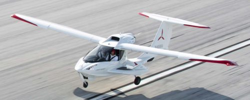
ICON recently held an event at Glacier Park International Airport, offering prospective A5 customers the chance to experience the aircraft in Big Sky country. Before taking customers up, and while developing our demo profile, we took a look at the charts and water locations for the general area. Below are some of the considerations we made in our flight planning, including the known challenges of operating in high density altitude environments. The ICON A5 has a normally aspirated Rotax 912iS (100hp) powerplant, not specifically built for higher altitude operations. That being said, how did the A5 perform in these hot and higher conditions?
How did the ICON Team determine whether these areas would even be workable before taking to the air?
For those interested in flying the ICON A5 in Montana or the surrounding area, below is where we flew, what we considered, and ultimately how the A5 performed,
Where is Glacier Park International Airport?
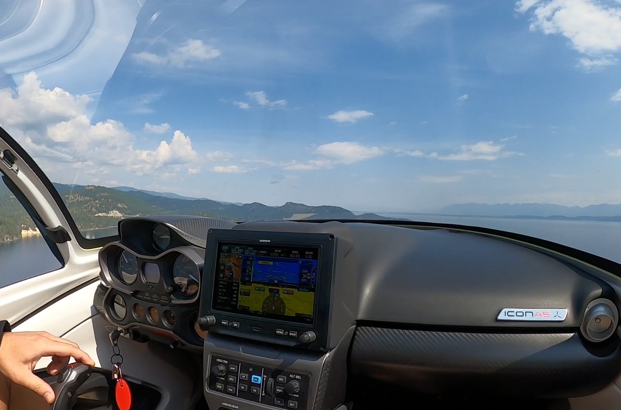
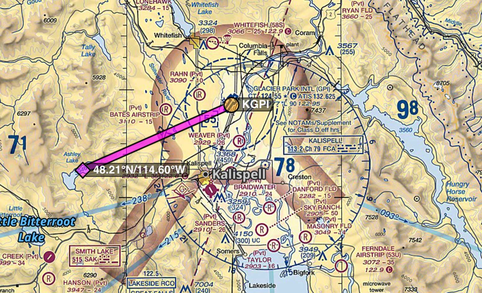
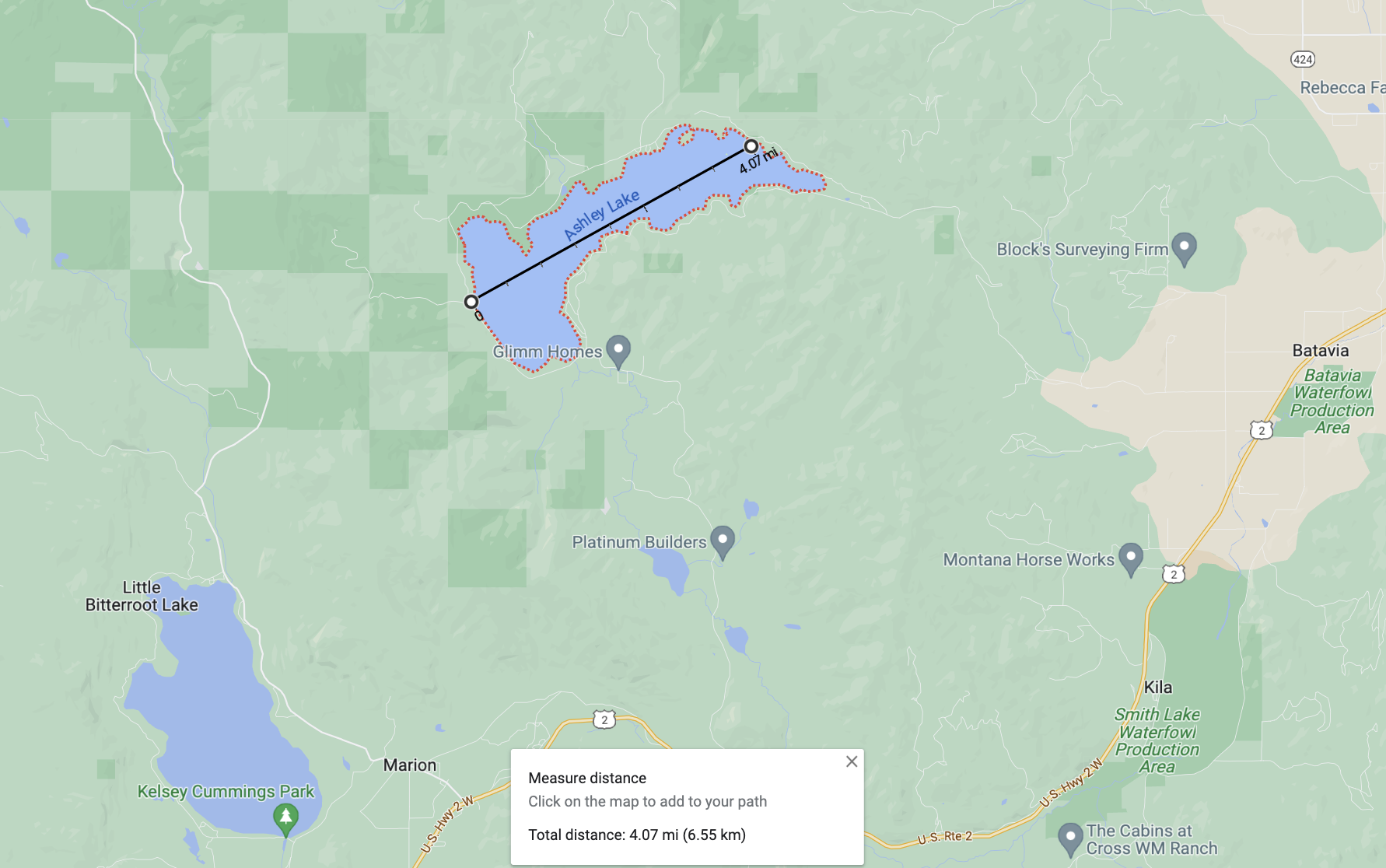
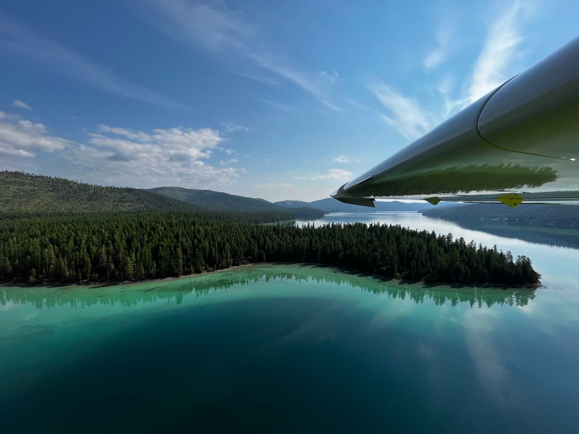
We flew out of Glacier Park International Airport, the identifier of which, is kind of confusing. Glacier Park International Airport is referred to as GPI or FCA, depending on whether you’re on the airfield or booking an airplane ticket. Regardless, both GPI and FCA refer to Glacier Park International Airport in Montana. From Glacier Park International, it is a roughly ten-minute flight in the ICON A5 to Glacier’s most prominent landmark: Flathead Lake. At 26 statute miles long, Flathead Lake is one of the largest freshwater lakes in the United States. While it is an intriguing destination, our team sought out a few, more private (and colorful) destinations for our demo profile. Looking at the map, Ashley Lake caught our attention.
When departing on runway 20, instead of turning south towards Flathead Lake, we ventured slightly west to Ashley Lake.
Conditions at takeoff:
- Takeoff Location: Glacier Park International Airport
- Elevation: 2,977 ft.
- Density Altitude (according to ForeFlight): 5,300 ft.
- Runway Length: 9,007 ft.
- Visibility: Minor Haze (smoke in the area)
Conditions at our destination:
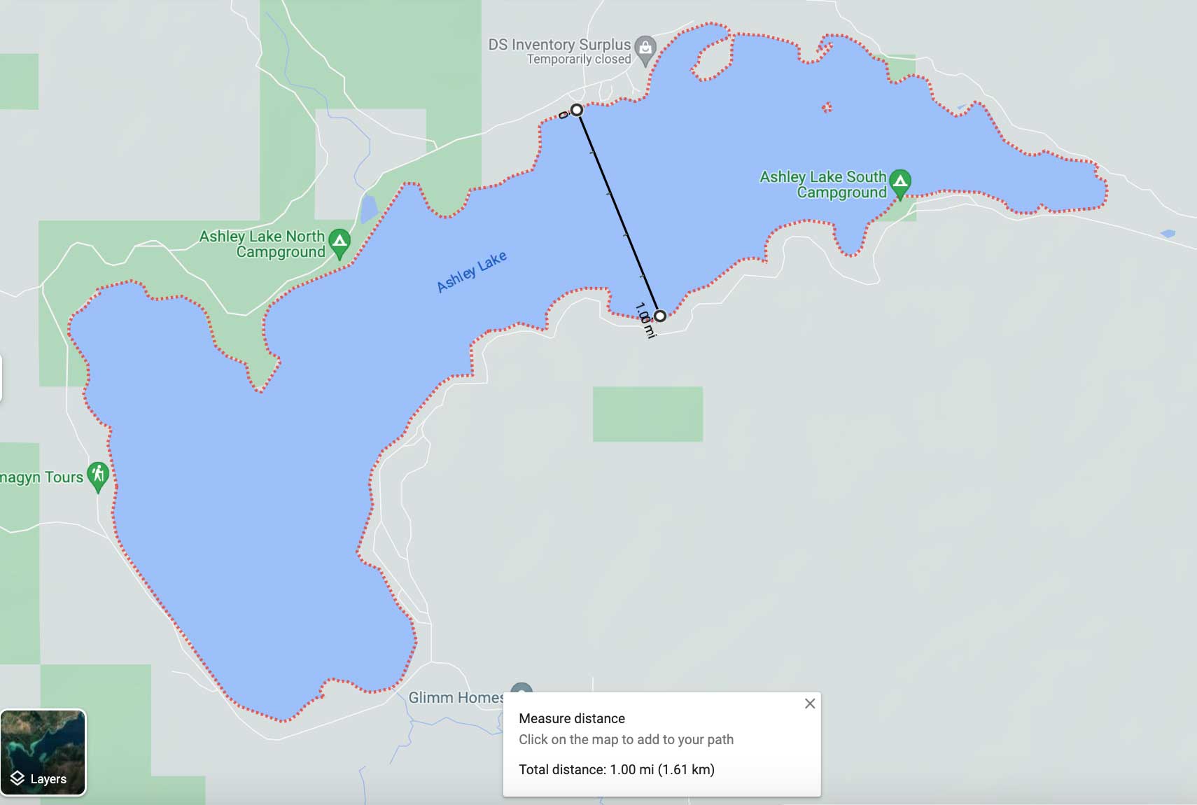
- Planned Destination: Ashley Lake (Above)
- Elevation: 3,946 ft.
- Estimated Density Altitude: 6,300 ft.
- Length: 4 statute miles
- Width: 1 statute mile
- Visibility: Clear, minor haze (smoke)
- Airport within 10nm (y/n): Yes
Taking off on the water at high density altitudes
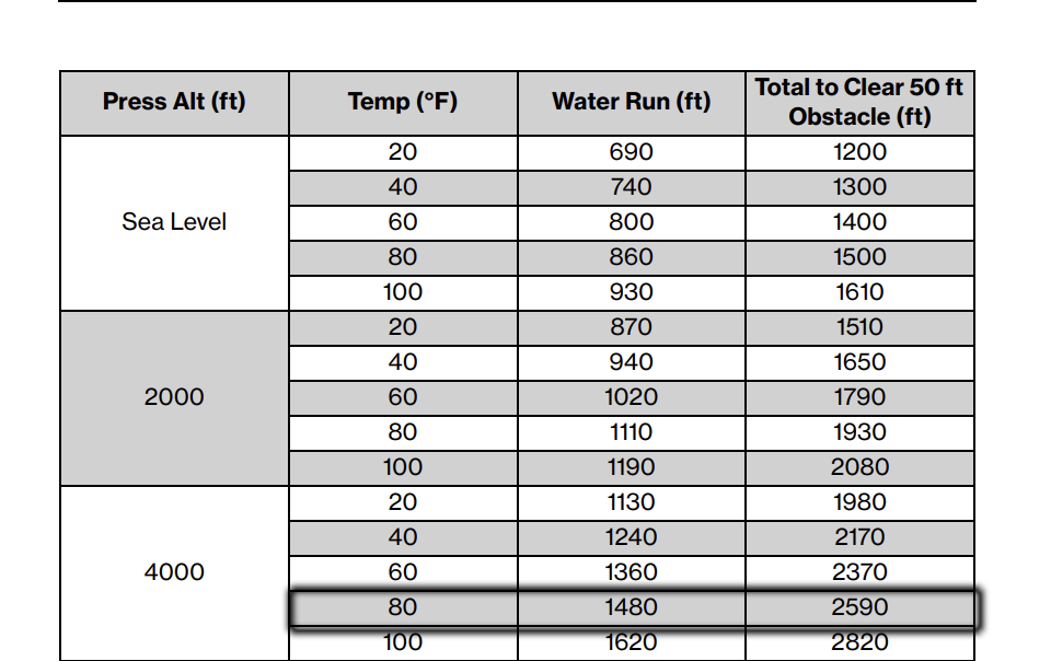
According to the chart from the ICON A5 POH, pictured above, the A5 is expected to take up 800 ft. on the water run in standard conditions. As mentioned above, on the day we were flying, conditions at Ashley Lake were non-standard. Using the conditions at the closest airport—about 10nm from the lake—we can say the temperature was roughly 80 degrees Fahrenheit at a 4,000 ft pressure altitude (based on Ashley Lake’s 3,946 elevation according to the charts). Ergo, we can expect a water run of about 1500 ft., or a little more than twice at what would occur at sea level during standard conditions.
Sure enough, in real time and based on our rough measurements, our water run was likely closer to 1800 ft. to 2000 ft.— about a third of a mile. It goes without saying: book values and the actual performance data may vary. Always give yourself some margin as a safe pilot can never expect book values to be exact.
While we measured Ashley Lake and knew it was plenty long to accommodate our water run (assuming the lake isn’t consumed by boats causing numerous wakes), it may feel a bit unusual for pilots to spend this much time on the water. Regardless, the A5 had more than enough power and room to work with.
But what if it we were required to clear a 50 ft. obstacle on takeoff? Another factor that makes Ashley Lake workable at high density altitudes is the relatively low terrain surrounding the ingress and egress corridors of the lake. What if that wasn’t the case? Looking at the above chart once more, if we had a 50 ft. obstacle to clear, notice that the water run increases almost a thousand feet to 2590 ft. In real time, that could mean a half a mile would be needed for our water run to clear the 50 ft. obstacle.
Even if the lake you are operating out of may be at, say 4000 ft. density altitude, if it is surrounded by higher terrain, you may have to climb higher to exit the area. Terrain may allow for only one way in and one way out, which can drastically affect the flight. An immediate example of this is Lake Isabel near Seattle, WA, which we discussed in a video here. This climb will be affected by the aircraft’s lack of performance. Look at the chart below to understand this. Most ICON A5 pilots expect to climb over 600 ft. / minute in standard conditions. But in the conditions we were working with on Ashley Lake, our climb rate would be an expected 466 ft. / minute. The ability to outclimb terrain must always be considered, but especially in higher areas on hotter days.
Finally, recognize there is no magic fix to decreasing your water run on high density altitude days. The only ways to increase performance in non-standard conditions are to reduce weight (take less fuel or remove gear) or wait until the temperature goes down (fly later or earlier in the day).
Does the critical angle of attack change with density altitude?
Given the ICON A5’s focus on flying by AoA, it’s worth a fuller discussion on how operating in higher, hotter environments affects angle of attack. As a reminder, an aircraft’s wing stalls when it reaches it’s critical angle of attack, when the wing no long produces sufficient lift. Given that stalls and aircraft performance are often discussed together, it’s natural to assume the critical angle of attack might also change with a change in aircraft performance. But it does not. Technically, an aircraft’s critical angle of attack is the same regardless of airspeed, weight, and, well, density altitude. The angle at which an aircraft’s wing stalls does not change with an increase in density altitude. What does occur is a less efficient airplane and therefore flying at a higher angle of attack.
Higher density altitudes result in fewer air molecules (less air density) in which to “lift” the airplane. To compensate for this, in order to reach your altitude or maintain straight-and-level flight, the aircraft will need a higher angle of attack (the nose will be pitched higher) than is traditionally the case. Why is this significant? Well, flying at a higher angle of attack puts the aircraft closer to the critical angle of attack.
This is why flight planning in high density altitude environments is so, well, critical. From the moment you take off, your wing is more vulnerable to stalling. In plain terms, the aircraft requires a higher pitch attitude to generate lift, introducing more drag and causing a decrease in performance.
High density altitudes puts planes, and the people piloting them, at a disadvantage. Proper flight planning requires this mindset and should shape every decision you make.
Safety considerations for operating out of mountain lakes
- Consider not venturing too far from a local airport that has fuel
- Measure the width and length of the lake
- Plan for boat traffic
- Tell someone when and where you’re going; check in with them before, during, and after your flight
- Understand the prevailing winds
- Have an alternate route
- Perform a high recon
- Account for obstacles and terrain along entry and exit corridors
So, how does the ICON A5 perform in Montana?
Overall, if the proper precautions and flight planning considerations are met, Montana is one of the most enjoyable destinations for the A5. Compared to Wyoming (Jackson Hole/Alpine area), the elevation near Glacier Park International Airport is manageable. Pilots will certainly notice the decrease in performance, but there are several lakes long and wide enough to accommodate the A5 water run in non-standard conditions.
Additionally, there are a number of workable bodies of water in all four cardinal directions within a 15-minute flight from Glacier Park International airport. Each of which provide a unique backdrop, be it the vistas of Glacier National Park or the turquoise waters at Ashley Lake. It’s a very diverse region for those who respect the conditions, while not excluding pilots becoming familiar with flying at higher density altitudes.

Paul is the Director of Marketing for ICON Aircraft. Before ICON, Paul was the Director of Video and Branded Content for Ranker, INC. and The Wrap. He was the host of Hulu's first original production, The Morning After, and co-developed Twitch.TV's first talk show, Game Talk Live. He is a private pilot based out of Pasadena, CA.